Navigation
Reeds Marine Distance Tables 10th edition 2007
£8.25 £25.00
SPECIAL OFFER - 67% DISCOUNT
NP5011 Symbols and Abbreviations Admiralty Charts (Chart 5011), 8th Edition
£30.00
A key to the symbols and abbreviations used on Admiralty and International paper charts compiled by the United Kingdom Hydrographic Office.
The Colregs Guide, 7th Edition
£30.00
The ‘Regulations for Preventing Collisions at Sea’ (basically, ‘Traffic Rules at Sea) should be essential reference material for every seafarer. Surfboarders to super tanker crews should all have the same knowledge and interpretation of the rules.
Worked Examples in Relative Radar Plotting
£30.00
and other navigational graphical problems
Reeds Astro Navigation Tables 2025
£27.00 £30.00
10% OFF. This is the established book of annual astro-navigation tables compiled specifically for the needs of boaters.
ADMIRALTY - NP5012 - Guide to ENC Symbols Used in ECDIS
£30.00
NP 5012 offers detailed explanations and descriptions of both traditional and simplified forms of ENC symbols displayed in ECDIS, ensuring bridge crews possess the knowledge needed to navigate safely.
Brown's Tidal Streams, 19th Edition
£33.00
This new expanded edition has been completely revised using the most up to date information available, from the Hydrographic Dept.
Norie's Nautical Tables, 2022 Edition
£24.50 £35.00
30% off old edition. New edition is coming June 2025!!!!
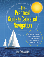
The Practical Guide to Celestial Navigation
£31.50 £35.00
The Practical Guide to Celestial Navigation: Step-by-step instructions for when you've lost the plot
Reeds Marine Distance Tables 18th Edition
£35.00
Reeds Marine Distance Tables are the perfect ready-reckoner for captains, navigators and owners of merchant and cruise ships large and small wanting a quick and accurate distance reference between all the regularly used commercial ports around the world. They are also of increasing value to the superyacht fleet.
Tides
£37.99
A Primer for Deck Officers and Officer of the Watch Exams
Practical Navigation for Officers of the Watch (OOW)
£38.00
The main subject matter covered relates to the use of charts and other Admiralty navigational publications, chart constructions, visual and radar terrestrial navigation, including the use of celestial bodies for the calculation of compass errors and position fixing.


